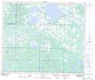
Maps showing Hare Island, 66-15-W4, Alberta
Hare Island is a Island located in 66-15-W4, Alberta and has an elevation of 570 meters.
- Latitude: 54° 43' 30'' North (decimal: 54.7250000)
- Longitude: 112° 9' 7'' West (decimal: -112.1519443)
- Topography Feature Category: Island
- Geographical Feature: Island
- Canadian Province/Territory: Alberta
- Elevation: 570 meters
- Location: 66-15-W4
- Atlas of Canada Locator Map: Hare Island
- GPS Coordinate Locator Map: Hare Island Lat/Long