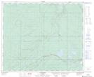
Maps showing Hargwen, 36-52-22-W5, Alberta
Hargwen is a Unincorporated area located in 36-52-22-W5, Alberta and has an elevation of 1062 meters.
- Latitude: 53° 32' 7'' North (decimal: 53.5352777)
- Longitude: 117° 6' 39'' West (decimal: -117.1108332)
- Topography Feature Category: Unincorporated area
- Geographical Feature: Locality
- Canadian Province/Territory: Alberta
- Elevation: 1062 meters
- Location: 36-52-22-W5
- Atlas of Canada Locator Map: Hargwen
- GPS Coordinate Locator Map: Hargwen Lat/Long