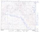
Maps showing Hartshorn, 22-34-17-W4, Alberta
Hartshorn is a Unincorporated area located in 22-34-17-W4, Alberta and has an elevation of 845 meters.
- Latitude: 51° 56' 12'' North (decimal: 51.9366666)
- Longitude: 112° 20' 25'' West (decimal: -112.3402777)
- Topography Feature Category: Unincorporated area
- Geographical Feature: Locality
- Canadian Province/Territory: Alberta
- Elevation: 845 meters
- Location: 22-34-17-W4
- Atlas of Canada Locator Map: Hartshorn
- GPS Coordinate Locator Map: Hartshorn Lat/Long
Hartshorn NTS Map Sheets