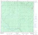
Maps showing Havet Creek, 96-25-W5, Alberta
Havet Creek is a River located in 96-25-W5, Alberta and has an elevation of 735 meters.
- Latitude: 57° 20' 47'' North (decimal: 57.3463888)
- Longitude: 117° 57' 58'' West (decimal: -117.9661110)
- Topography Feature Category: River
- Geographical Feature: Creek
- Canadian Province/Territory: Alberta
- Elevation: 735 meters
- Location: 96-25-W5
- Atlas of Canada Locator Map: Havet Creek
- GPS Coordinate Locator Map: Havet Creek Lat/Long
Havet Creek NTS Map Sheets