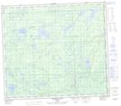
Maps showing McMullen Lake, 79-1-W5, Alberta
McMullen Lake is a Lake located in 79-1-W5, Alberta and has an elevation of 585 meters.
- Latitude: 55° 50' 25'' North (decimal: 55.8402777)
- Longitude: 114° 5' 30'' West (decimal: -114.0916667)
- Topography Feature Category: Lake
- Geographical Feature: Lake
- Canadian Province/Territory: Alberta
- Elevation: 585 meters
- Location: 79-1-W5
- Atlas of Canada Locator Map: McMullen Lake
- GPS Coordinate Locator Map: McMullen Lake Lat/Long
McMullen Lake NTS Map Sheets