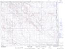
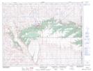
Maps showing Medicine Lodge Coulee, 7-3-W4, Alberta
Medicine Lodge Coulee is a Valley located in 7-3-W4, Alberta and has an elevation of 1088 meters.
- Latitude: 49° 34' 32'' North (decimal: 49.5756000)
- Longitude: 110° 22' 20'' West (decimal: -110.3722000)
- Topography Feature Category: Valley
- Geographical Feature: Coulee
- Canadian Province/Territory: Alberta
- Elevation: 1088 meters
- Location: 7-3-W4
- Atlas of Canada Locator Map: Medicine Lodge Coulee
- GPS Coordinate Locator Map: Medicine Lodge Coulee Lat/Long
Medicine Lodge Coulee NTS Map Sheets