Maps showing Merryweather Lake, 119-20-W4, Alberta
Merryweather Lake is a Lake located in 119-20-W4, Alberta and has an elevation of 296 meters.
- Latitude: 59° 20' 56'' North (decimal: 59.3488888)
- Longitude: 113° 20' 33'' West (decimal: -113.3424999)
- Topography Feature Category: Lake
- Geographical Feature: Lake
- Canadian Province/Territory: Alberta
- Elevation: 296 meters
- Location: 119-20-W4
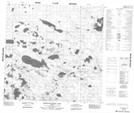
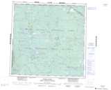
- Atlas of Canada Locator Map: Merryweather Lake
- GPS Coordinate Locator Map: Merryweather Lake Lat/Long
Merryweather Lake NTS Map Sheets