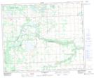
Maps showing Mewassin, 31-51-2-W5, Alberta
Mewassin is a Unincorporated area located in 31-51-2-W5, Alberta and has an elevation of 711 meters.
- Latitude: 53° 27' 13'' North (decimal: 53.4536111)
- Longitude: 114° 17' 57'' West (decimal: -114.2991666)
- Topography Feature Category: Unincorporated area
- Geographical Feature: Locality
- Canadian Province/Territory: Alberta
- Elevation: 711 meters
- Location: 31-51-2-W5
- Atlas of Canada Locator Map: Mewassin
- GPS Coordinate Locator Map: Mewassin Lat/Long
Mewassin NTS Map Sheets