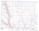
Maps showing Michichi Reservoir, 19-30-18-W4, Alberta
Michichi Reservoir is a Lake located in 19-30-18-W4, Alberta and has an elevation of 836 meters.
- Latitude: 51° 35' North (decimal: 51.5833000)
- Longitude: 112° 32' West (decimal: -112.5332999)
- Topography Feature Category: Lake
- Geographical Feature: Reservoir
- Canadian Province/Territory: Alberta
- Elevation: 836 meters
- Location: 19-30-18-W4
- Atlas of Canada Locator Map: Michichi Reservoir
- GPS Coordinate Locator Map: Michichi Reservoir Lat/Long