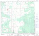
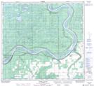
Maps showing Linton Lake, 105,106-15,16-W5, Alberta
Linton Lake is a Lake located in 105,106-15,16-W5, Alberta and has an elevation of 321 meters.
- Latitude: 58° 10' 10'' North (decimal: 58.1694444)
- Longitude: 116° 28' 58'' West (decimal: -116.4827777)
- Topography Feature Category: Lake
- Geographical Feature: Lake
- Canadian Province/Territory: Alberta
- Elevation: 321 meters
- Location: 105,106-15,16-W5
- Atlas of Canada Locator Map: Linton Lake
- GPS Coordinate Locator Map: Linton Lake Lat/Long
Linton Lake NTS Map Sheets