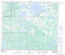
Maps showing Little Beaver Lake, 2-65-16-W4, Alberta
Little Beaver Lake is a Lake located in 2-65-16-W4, Alberta and has an elevation of 577 meters.
- Latitude: 54° 35' 41'' North (decimal: 54.5947221)
- Longitude: 112° 18' 38'' West (decimal: -112.3105556)
- Topography Feature Category: Lake
- Geographical Feature: Lake
- Canadian Province/Territory: Alberta
- Elevation: 577 meters
- Location: 2-65-16-W4
- Atlas of Canada Locator Map: Little Beaver Lake
- GPS Coordinate Locator Map: Little Beaver Lake Lat/Long