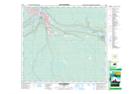
Maps showing Little Fishery River, 89-10-W4, Alberta
Little Fishery River is a River located in 89-10-W4, Alberta and has an elevation of 515 meters.
- Latitude: 56° 42' 48'' North (decimal: 56.7133332)
- Longitude: 111° 26' 23'' West (decimal: -111.4397222)
- Topography Feature Category: River
- Geographical Feature: River
- Canadian Province/Territory: Alberta
- Elevation: 515 meters
- Location: 89-10-W4
- Atlas of Canada Locator Map: Little Fishery River
- GPS Coordinate Locator Map: Little Fishery River Lat/Long
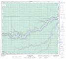
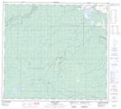
Little Fishery River NTS Map Sheets