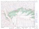
Maps showing Battle Creek, 8-30-W3, Alberta
Battle Creek is a River located in 8-30-W3, Alberta and has an elevation of 1272 meters.
- Latitude: 49° 38' 54'' North (decimal: 49.6483333)
- Longitude: 110° 0' 18'' West (decimal: -110.0049999)
- Topography Feature Category: River
- Geographical Feature: Creek
- Canadian Province/Territory: Alberta
- Elevation: 1272 meters
- Location: 8-30-W3
- Atlas of Canada Locator Map: Battle Creek
- GPS Coordinate Locator Map: Battle Creek Lat/Long
Battle Creek NTS Map Sheets