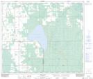
Maps showing Brush Mountain, 69-18-W5, Alberta
Brush Mountain is a Mountain located in 69-18-W5, Alberta and has an elevation of 930 meters.
- Latitude: 55° 1' 27'' North (decimal: 55.0241666)
- Longitude: 116° 37' 22'' West (decimal: -116.6227778)
- Topography Feature Category: Mountain
- Geographical Feature: Mountain
- Canadian Province/Territory: Alberta
- Elevation: 930 meters
- Location: 69-18-W5
- Atlas of Canada Locator Map: Brush Mountain
- GPS Coordinate Locator Map: Brush Mountain Lat/Long
Brush Mountain NTS Map Sheets