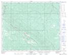
Maps showing Bryan Creek Coal Company, 15-49-21-W5, Alberta
Bryan Creek Coal Company is a Unincorporated area located in 15-49-21-W5, Alberta.
- Latitude: 53° 14' 00'' North (decimal: 53.2332999)
- Longitude: 116° 58' 50'' West (decimal: -116.9805999)
- Topography Feature Category: Unincorporated area
- Geographical Feature: Locality
- Canadian Province/Territory: Alberta
- Location: 15-49-21-W5
- GPS Coordinate Locator Map: Bryan Creek Coal Company Lat/Long