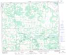
Maps showing Bucklake Creek, 17-50-5-W5, Alberta
Bucklake Creek is a River located in 17-50-5-W5, Alberta and has an elevation of 716 meters.
- Latitude: 53° 18' 55'' North (decimal: 53.3152778)
- Longitude: 114° 41' 52'' West (decimal: -114.6977777)
- Topography Feature Category: River
- Geographical Feature: Creek
- Canadian Province/Territory: Alberta
- Elevation: 716 meters
- Location: 17-50-5-W5
- Atlas of Canada Locator Map: Bucklake Creek
- GPS Coordinate Locator Map: Bucklake Creek Lat/Long
Bucklake Creek NTS Map Sheets