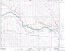
Maps showing Buffalo, 30-21-5-W4, Alberta
Buffalo is a Unincorporated area located in 30-21-5-W4, Alberta and has an elevation of 710 meters.
- Latitude: 50° 48' 36'' North (decimal: 50.8099999)
- Longitude: 110° 40' 53'' West (decimal: -110.6813889)
- Topography Feature Category: Unincorporated area
- Geographical Feature: Locality
- Canadian Province/Territory: Alberta
- Elevation: 710 meters
- Location: 30-21-5-W4
- Atlas of Canada Locator Map: Buffalo
- GPS Coordinate Locator Map: Buffalo Lat/Long
Buffalo NTS Map Sheets