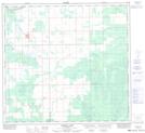
Maps showing Buffalo Head Prairie, 26-104-15-W5, Alberta
Buffalo Head Prairie is a Unincorporated area located in 26-104-15-W5, Alberta and has an elevation of 344 meters.
- Latitude: 58° 3' 3'' North (decimal: 58.0508333)
- Longitude: 116° 20' 58'' West (decimal: -116.3494443)
- Topography Feature Category: Unincorporated area
- Geographical Feature: Hamlet
- Canadian Province/Territory: Alberta
- Elevation: 344 meters
- Location: 26-104-15-W5
- Atlas of Canada Locator Map: Buffalo Head Prairie
- GPS Coordinate Locator Map: Buffalo Head Prairie Lat/Long
Buffalo Head Prairie NTS Map Sheets