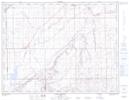
Maps showing Bullshead, 22-11-6-W4, Alberta
Bullshead is a Unincorporated area located in 22-11-6-W4, Alberta and has an elevation of 733 meters.
- Latitude: 49° 55' 33'' North (decimal: 49.9258333)
- Longitude: 110° 44' 56'' West (decimal: -110.7488888)
- Topography Feature Category: Unincorporated area
- Geographical Feature: Locality
- Canadian Province/Territory: Alberta
- Elevation: 733 meters
- Location: 22-11-6-W4
- Atlas of Canada Locator Map: Bullshead
- GPS Coordinate Locator Map: Bullshead Lat/Long
Bullshead NTS Map Sheets