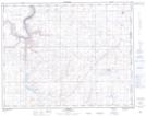
Maps showing Bull Springs Coulée, 17-3,4-W4, Alberta
Bull Springs Coulée is a Valley located in 17-3,4-W4, Alberta and has an elevation of 658 meters.
- Latitude: 50° 25' 2'' North (decimal: 50.4172222)
- Longitude: 110° 25' 1'' West (decimal: -110.4169443)
- Topography Feature Category: Valley
- Geographical Feature: Coulée
- Canadian Province/Territory: Alberta
- Elevation: 658 meters
- Location: 17-3,4-W4
- Atlas of Canada Locator Map: Bull Springs Coulée
- GPS Coordinate Locator Map: Bull Springs Coulée Lat/Long