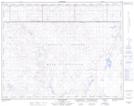
Maps showing South Easy Coulee, 18-6,7-W4, Alberta
South Easy Coulee is a Valley located in 18-6,7-W4, Alberta and has an elevation of 795 meters.
- Latitude: 50° 35' North (decimal: 50.5833333)
- Longitude: 110° 52' West (decimal: -110.8666666)
- Topography Feature Category: Valley
- Geographical Feature: Coulee
- Canadian Province/Territory: Alberta
- Elevation: 795 meters
- Location: 18-6,7-W4
- Atlas of Canada Locator Map: South Easy Coulee
- GPS Coordinate Locator Map: South Easy Coulee Lat/Long
South Easy Coulee NTS Map Sheets