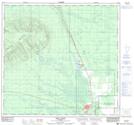
Maps showing High Level, 110-19-W5, Alberta
High Level is a Town located in 110-19-W5, Alberta and has an elevation of 328 meters.
- Latitude: 58° 31' 5'' North (decimal: 58.5180555)
- Longitude: 117° 7' 44'' West (decimal: -117.1288888)
- Topography Feature Category: Town
- Geographical Feature: Town
- Canadian Province/Territory: Alberta
- Elevation: 328 meters
- Location: 110-19-W5
- Atlas of Canada Locator Map: High Level
- GPS Coordinate Locator Map: High Level Lat/Long
High Level NTS Map Sheets