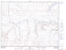
Maps showing Miners Coulée, 2-11-W4, Alberta
Miners Coulée is a Valley located in 2-11-W4, Alberta and has an elevation of 912 meters.
- Latitude: 49° 6' 13'' North (decimal: 49.1036111)
- Longitude: 111° 23' 22'' West (decimal: -111.3894443)
- Topography Feature Category: Valley
- Geographical Feature: Coulée
- Canadian Province/Territory: Alberta
- Elevation: 912 meters
- Location: 2-11-W4
- Atlas of Canada Locator Map: Miners Coulée
- GPS Coordinate Locator Map: Miners Coulée Lat/Long