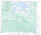
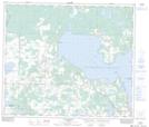
Maps showing Missawawi Lake, 66-15-W4, Alberta
Missawawi Lake is a Lake located in 66-15-W4, Alberta and has an elevation of 574 meters.
- Latitude: 54° 43' 35'' North (decimal: 54.7263888)
- Longitude: 112° 10' 12'' West (decimal: -112.1699999)
- Topography Feature Category: Lake
- Geographical Feature: Lake
- Canadian Province/Territory: Alberta
- Elevation: 574 meters
- Location: 66-15-W4
- Atlas of Canada Locator Map: Missawawi Lake
- GPS Coordinate Locator Map: Missawawi Lake Lat/Long
Missawawi Lake NTS Map Sheets