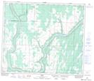
Maps showing Camping Lakes, 67,68-21-W4, Alberta
Camping Lakes is a Lake located in 67,68-21-W4, Alberta and has an elevation of 602 meters.
- Latitude: 54° 50' 4'' North (decimal: 54.8344444)
- Longitude: 113° 6' 29'' West (decimal: -113.1080555)
- Topography Feature Category: Lake
- Geographical Feature: Lakes
- Canadian Province/Territory: Alberta
- Elevation: 602 meters
- Location: 67,68-21-W4
- Atlas of Canada Locator Map: Camping Lakes
- GPS Coordinate Locator Map: Camping Lakes Lat/Long