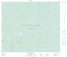
Maps showing Caribou Lake, 70-6-W4, Alberta
Caribou Lake is a Lake located in 70-6-W4, Alberta and has an elevation of 632 meters.
- Latitude: 55° 5' 17'' North (decimal: 55.0880555)
- Longitude: 110° 52' 18'' West (decimal: -110.8716667)
- Topography Feature Category: Lake
- Geographical Feature: Lake
- Canadian Province/Territory: Alberta
- Elevation: 632 meters
- Location: 70-6-W4
- Atlas of Canada Locator Map: Caribou Lake
- GPS Coordinate Locator Map: Caribou Lake Lat/Long
Caribou Lake NTS Map Sheets