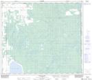
Maps showing Springburn, 16-80-19-W5, Alberta
Springburn is a Unincorporated area located in 16-80-19-W5, Alberta and has an elevation of 650 meters.
- Latitude: 55° 56' 6'' North (decimal: 55.9349999)
- Longitude: 116° 54' 39'' West (decimal: -116.9108333)
- Topography Feature Category: Unincorporated area
- Geographical Feature: Locality
- Canadian Province/Territory: Alberta
- Elevation: 650 meters
- Location: 16-80-19-W5
- Atlas of Canada Locator Map: Springburn
- GPS Coordinate Locator Map: Springburn Lat/Long
Springburn NTS Map Sheets