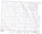
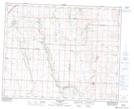
Maps showing Spruce Creek, 16-32-26-W4, Alberta
Spruce Creek is a River located in 16-32-26-W4, Alberta and has an elevation of 958 meters.
- Latitude: 51° 44' 34'' North (decimal: 51.7427777)
- Longitude: 113° 38' 3'' West (decimal: -113.6341666)
- Topography Feature Category: River
- Geographical Feature: Creek
- Canadian Province/Territory: Alberta
- Elevation: 958 meters
- Location: 16-32-26-W4
- Atlas of Canada Locator Map: Spruce Creek
- GPS Coordinate Locator Map: Spruce Creek Lat/Long
Spruce Creek NTS Map Sheets