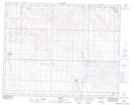
Maps showing Standard, 3-25-22-W4, Alberta
Standard is a Village located in 3-25-22-W4, Alberta and has an elevation of 895 meters.
- Latitude: 51° 6' 35'' North (decimal: 51.1097222)
- Longitude: 112° 59' 1'' West (decimal: -112.9836111)
- Topography Feature Category: Village
- Geographical Feature: Village
- Canadian Province/Territory: Alberta
- Elevation: 895 meters
- Location: 3-25-22-W4
- Atlas of Canada Locator Map: Standard
- GPS Coordinate Locator Map: Standard Lat/Long