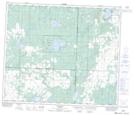
Maps showing Steele Lake, 65-25,26-W4, Alberta
Steele Lake is a Lake located in 65-25,26-W4, Alberta and has an elevation of 658 meters.
- Latitude: 54° 38' 55'' North (decimal: 54.6486111)
- Longitude: 113° 46' 32'' West (decimal: -113.7755556)
- Topography Feature Category: Lake
- Geographical Feature: Lake
- Canadian Province/Territory: Alberta
- Elevation: 658 meters
- Location: 65-25,26-W4
- Atlas of Canada Locator Map: Steele Lake
- GPS Coordinate Locator Map: Steele Lake Lat/Long