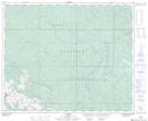
Maps showing Steeper, 13-48-22-W5, Alberta
Steeper is a Unincorporated area located in 13-48-22-W5, Alberta and has an elevation of 1376 meters.
- Latitude: 53° 8' North (decimal: 53.1333000)
- Longitude: 117° 5' West (decimal: -117.0832999)
- Topography Feature Category: Unincorporated area
- Geographical Feature: Locality
- Canadian Province/Territory: Alberta
- Elevation: 1376 meters
- Location: 13-48-22-W5
- Atlas of Canada Locator Map: Steeper
- GPS Coordinate Locator Map: Steeper Lat/Long