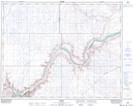
Maps showing Howie, 25-22-10-W4, Alberta
Howie is a Unincorporated area located in 25-22-10-W4, Alberta and has an elevation of 640 meters.
- Latitude: 50° 53' 3'' North (decimal: 50.8841666)
- Longitude: 111° 15' 27'' West (decimal: -111.2574999)
- Topography Feature Category: Unincorporated area
- Geographical Feature: Locality
- Canadian Province/Territory: Alberta
- Elevation: 640 meters
- Location: 25-22-10-W4
- Atlas of Canada Locator Map: Howie
- GPS Coordinate Locator Map: Howie Lat/Long