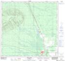
Maps showing Hutch Lake, 23-112-20-W5, Alberta
Hutch Lake is a Unincorporated area located in 23-112-20-W5, Alberta and has an elevation of 353 meters.
- Latitude: 58° 44' 47'' North (decimal: 58.7463888)
- Longitude: 117° 15' 47'' West (decimal: -117.2630555)
- Topography Feature Category: Unincorporated area
- Geographical Feature: Locality
- Canadian Province/Territory: Alberta
- Elevation: 353 meters
- Location: 23-112-20-W5
- Atlas of Canada Locator Map: Hutch Lake
- GPS Coordinate Locator Map: Hutch Lake Lat/Long
Hutch Lake NTS Map Sheets