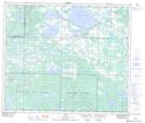
Maps showing Hylo, 4-66-15-W4, Alberta
Hylo is a Unincorporated area located in 4-66-15-W4, Alberta and has an elevation of 575 meters.
- Latitude: 54° 40' 39'' North (decimal: 54.6775000)
- Longitude: 112° 12' 41'' West (decimal: -112.2113889)
- Topography Feature Category: Unincorporated area
- Geographical Feature: Locality
- Canadian Province/Territory: Alberta
- Elevation: 575 meters
- Location: 4-66-15-W4
- Atlas of Canada Locator Map: Hylo
- GPS Coordinate Locator Map: Hylo Lat/Long