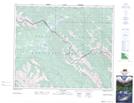
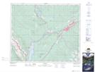
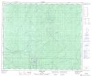
Maps showing Ice Water Creek, 52-27-W5, Alberta
Ice Water Creek is a River located in 52-27-W5, Alberta and has an elevation of 1299 meters.
- Latitude: 53° 30' 22'' North (decimal: 53.5061111)
- Longitude: 117° 58' 4'' West (decimal: -117.9677778)
- Topography Feature Category: River
- Geographical Feature: Creek
- Canadian Province/Territory: Alberta
- Elevation: 1299 meters
- Location: 52-27-W5
- Atlas of Canada Locator Map: Ice Water Creek
- GPS Coordinate Locator Map: Ice Water Creek Lat/Long
Ice Water Creek NTS Map Sheets