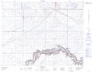
Maps showing Illingworth, 21-13-11-W4, Alberta
Illingworth is a Unincorporated area located in 21-13-11-W4, Alberta.
- Latitude: 50° 5' 46'' North (decimal: 50.0961110)
- Longitude: 111° 26' 30'' West (decimal: -111.4416666)
- Topography Feature Category: Unincorporated area
- Geographical Feature: Locality
- Canadian Province/Territory: Alberta
- Location: 21-13-11-W4
- Atlas of Canada Locator Map: Illingworth
- GPS Coordinate Locator Map: Illingworth Lat/Long
Illingworth NTS Map Sheets