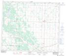
Maps showing Taylor Lake, 59-23-w4, Alberta
Taylor Lake is a Lake located in 59-23-w4, Alberta and has an elevation of 652 meters.
- Latitude: 54° 7' 7'' North (decimal: 54.1186111)
- Longitude: 113° 24' 59'' West (decimal: -113.4163889)
- Topography Feature Category: Lake
- Geographical Feature: Lake
- Canadian Province/Territory: Alberta
- Elevation: 652 meters
- Location: 59-23-w4
- Atlas of Canada Locator Map: Taylor Lake
- GPS Coordinate Locator Map: Taylor Lake Lat/Long