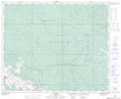
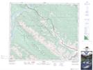
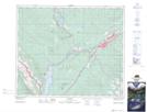
Maps showing Teepee Creek, 23-49-24-W5, Alberta
Teepee Creek is a River located in 23-49-24-W5, Alberta and has an elevation of 1272 meters.
- Latitude: 53° 14' 51'' North (decimal: 53.2474999)
- Longitude: 117° 23' 41'' West (decimal: -117.3947221)
- Topography Feature Category: River
- Geographical Feature: Creek
- Canadian Province/Territory: Alberta
- Elevation: 1272 meters
- Location: 23-49-24-W5
- Atlas of Canada Locator Map: Teepee Creek
- GPS Coordinate Locator Map: Teepee Creek Lat/Long
Teepee Creek NTS Map Sheets