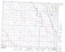
Maps showing Ten Mile Creek, 31-28-W4, Alberta
Ten Mile Creek is a River located in 31-28-W4, Alberta and has an elevation of 943 meters.
- Latitude: 51° 42' 4'' North (decimal: 51.7011111)
- Longitude: 113° 52' 2'' West (decimal: -113.8672222)
- Topography Feature Category: River
- Geographical Feature: Creek
- Canadian Province/Territory: Alberta
- Elevation: 943 meters
- Location: 31-28-W4
- Atlas of Canada Locator Map: Ten Mile Creek
- GPS Coordinate Locator Map: Ten Mile Creek Lat/Long
Ten Mile Creek NTS Map Sheets