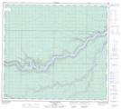
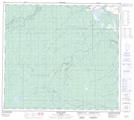
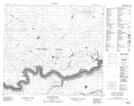
Maps showing Thickwood Hills, 88-15-W4, Alberta
Thickwood Hills is a Mountain located in 88-15-W4, Alberta and has an elevation of 542 meters.
- Latitude: 56° 42' 40'' North (decimal: 56.7111669)
- Longitude: 112° 13' 56'' West (decimal: -112.2323610)
- Topography Feature Category: Mountain
- Geographical Feature: Hills
- Canadian Province/Territory: Alberta
- Elevation: 542 meters
- Location: 88-15-W4
- Atlas of Canada Locator Map: Thickwood Hills
- GPS Coordinate Locator Map: Thickwood Hills Lat/Long
Thickwood Hills NTS Map Sheets
074D12 Cascade Rapids Topographic Map at 1:50,000 scale
074D13 Ruth Lake Topographic Map at 1:50,000 scale
084A09 Boiler Rapids Topographic Map at 1:50,000 scale
084A10 Brule Point Topographic Map at 1:50,000 scale
074D Fort Mcmurray Topographic Map at 1:250,000 scale
084A Algar Lake Topographic Map at 1:250,000 scale
074D13 Ruth Lake Topographic Map at 1:50,000 scale
084A09 Boiler Rapids Topographic Map at 1:50,000 scale
084A10 Brule Point Topographic Map at 1:50,000 scale
074D Fort Mcmurray Topographic Map at 1:250,000 scale
084A Algar Lake Topographic Map at 1:250,000 scale