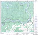
Maps showing Moose Island, 104,105-16,17-W5, Alberta
Moose Island is a Island located in 104,105-16,17-W5, Alberta and has an elevation of 259 meters.
- Latitude: 58° 4' 48'' North (decimal: 58.0800000)
- Longitude: 116° 37' 49'' West (decimal: -116.6302777)
- Topography Feature Category: Island
- Geographical Feature: Island
- Canadian Province/Territory: Alberta
- Elevation: 259 meters
- Location: 104,105-16,17-W5
- Atlas of Canada Locator Map: Moose Island
- GPS Coordinate Locator Map: Moose Island Lat/Long
Moose Island NTS Map Sheets