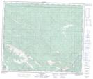
Maps showing Morley Hill, 60-8-W6, Alberta
Morley Hill is a Mountain located in 60-8-W6, Alberta and has an elevation of 1620 meters.
- Latitude: 54° 13' 19'' North (decimal: 54.2219444)
- Longitude: 119° 8' 40'' West (decimal: -119.1444444)
- Topography Feature Category: Mountain
- Geographical Feature: Hill
- Canadian Province/Territory: Alberta
- Elevation: 1620 meters
- Location: 60-8-W6
- Atlas of Canada Locator Map: Morley Hill
- GPS Coordinate Locator Map: Morley Hill Lat/Long
Morley Hill NTS Map Sheets