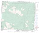
Maps showing Mouse Cache Creek, 59-13-W6, Alberta
Mouse Cache Creek is a River located in 59-13-W6, Alberta and has an elevation of 1313 meters.
- Latitude: 54° 6' 38'' North (decimal: 54.1105555)
- Longitude: 119° 52' 33'' West (decimal: -119.8758332)
- Topography Feature Category: River
- Geographical Feature: Creek
- Canadian Province/Territory: Alberta
- Elevation: 1313 meters
- Location: 59-13-W6
- Atlas of Canada Locator Map: Mouse Cache Creek
- GPS Coordinate Locator Map: Mouse Cache Creek Lat/Long