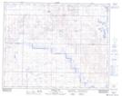
Maps showing Chain Lakes, 33-16-W4, Alberta
Chain Lakes is a Lake located in 33-16-W4, Alberta and has an elevation of 807 meters.
- Latitude: 51° 49' 32'' North (decimal: 51.8255555)
- Longitude: 112° 10' 28'' West (decimal: -112.1744444)
- Topography Feature Category: Lake
- Geographical Feature: Lakes
- Canadian Province/Territory: Alberta
- Elevation: 807 meters
- Location: 33-16-W4
- Atlas of Canada Locator Map: Chain Lakes
- GPS Coordinate Locator Map: Chain Lakes Lat/Long
Chain Lakes NTS Map Sheets