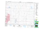
Maps showing Cheadle, 2-24-26-W4, Alberta
Cheadle is a Unincorporated area located in 2-24-26-W4, Alberta and has an elevation of 988 meters.
- Latitude: 51° 0' 52'' North (decimal: 51.0144444)
- Longitude: 113° 32' 26'' West (decimal: -113.5405555)
- Topography Feature Category: Unincorporated area
- Geographical Feature: Locality
- Canadian Province/Territory: Alberta
- Elevation: 988 meters
- Location: 2-24-26-W4
- Atlas of Canada Locator Map: Cheadle
- GPS Coordinate Locator Map: Cheadle Lat/Long