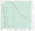
Maps showing Stony Island, 91-9-W4, Alberta
Stony Island is a Island located in 91-9-W4, Alberta and has an elevation of 241 meters.
- Latitude: 56° 52' 35'' North (decimal: 56.8763888)
- Longitude: 111° 25' 30'' West (decimal: -111.4250000)
- Topography Feature Category: Island
- Geographical Feature: Island
- Canadian Province/Territory: Alberta
- Elevation: 241 meters
- Location: 91-9-W4
- Atlas of Canada Locator Map: Stony Island
- GPS Coordinate Locator Map: Stony Island Lat/Long
Stony Island NTS Map Sheets