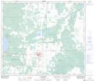
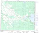
Maps showing Sturgeon Lake, 70,71-23,24-W5, Alberta
Sturgeon Lake is a Lake located in 70,71-23,24-W5, Alberta and has an elevation of 688 meters.
- Latitude: 55° 6' 16'' North (decimal: 55.1044444)
- Longitude: 117° 34' 7'' West (decimal: -117.5686110)
- Topography Feature Category: Lake
- Geographical Feature: Lake
- Canadian Province/Territory: Alberta
- Elevation: 688 meters
- Location: 70,71-23,24-W5
- Atlas of Canada Locator Map: Sturgeon Lake
- GPS Coordinate Locator Map: Sturgeon Lake Lat/Long
Sturgeon Lake NTS Map Sheets