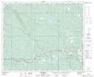
Maps showing Sucker Lake, W7, 18-53-20-W5, Alberta
Sucker Lake is a Lake located in W7, 18-53-20-W5, Alberta and has an elevation of 1017 meters.
- Latitude: 53° 34' 21'' North (decimal: 53.5724999)
- Longitude: 116° 56' 34'' West (decimal: -116.9427777)
- Topography Feature Category: Lake
- Geographical Feature: Lake
- Canadian Province/Territory: Alberta
- Elevation: 1017 meters
- Location: W7, 18-53-20-W5
- Atlas of Canada Locator Map: Sucker Lake
- GPS Coordinate Locator Map: Sucker Lake Lat/Long