Canada Topographic Maps

Sullivan Lake Topo Maps

Topography maps and Latitude/Longitude Location

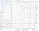
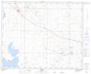
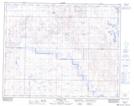
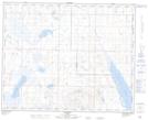
Maps showing Sullivan Lake, 34,37-14,15-W4, Alberta

Sullivan Lake is a Lake located in 34,37-14,15-W4, Alberta and has an elevation of 809 meters.

  • Latitude: 52° 0' 52'' North   (decimal: 52.0144444)
  • Longitude: 111° 57' 55'' West   (decimal: -111.9652777)
  • Topography Feature Category: Lake
  • Geographical Feature: Lake
  • Canadian Province/Territory: Alberta
  • Elevation: 809 meters
  • Location: 34,37-14,15-W4
  • Atlas of Canada Locator Map: Sullivan Lake
  • GPS Coordinate Locator Map: Sullivan Lake Lat/Long

Sullivan Lake NTS Map Sheets

072M13 Bloor Lake Topographic Map at 1:50,000 scale

073D04 Castor Topographic Map at 1:50,000 scale

082P16 Farrell Lake Topographic Map at 1:50,000 scale

083A01 Hackett Topographic Map at 1:50,000 scale

072M Oyen Topographic Map at 1:250,000 scale

073D Wainwright Topographic Map at 1:250,000 scale

082P Drumheller Topographic Map at 1:250,000 scale

083A Red Deer Topographic Map at 1:250,000 scale

 
Buy Topographic Maps DVD
Newsletter Sign-up

Yes, I want to receive map store discounts.


Bookmark and Share