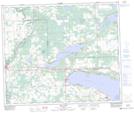
Maps showing Sundance, 36-52-5-W5, Alberta
Sundance is a Unincorporated area located in 36-52-5-W5, Alberta and has an elevation of 728 meters.
- Latitude: 53° 31' 50'' North (decimal: 53.5305555)
- Longitude: 114° 35' 49'' West (decimal: -114.5969444)
- Topography Feature Category: Unincorporated area
- Geographical Feature: Locality
- Canadian Province/Territory: Alberta
- Elevation: 728 meters
- Location: 36-52-5-W5
- Atlas of Canada Locator Map: Sundance
- GPS Coordinate Locator Map: Sundance Lat/Long
Sundance NTS Map Sheets